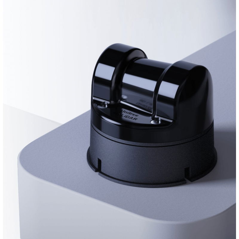


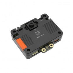


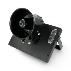


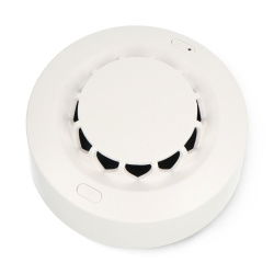

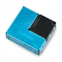

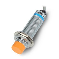
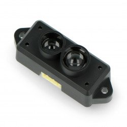
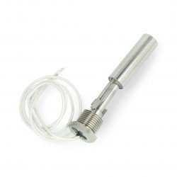
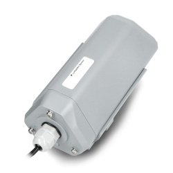


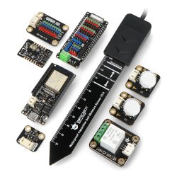


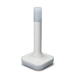


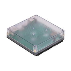
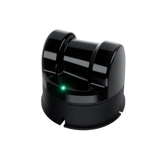


The Unitree L2 RM LiDAR is a precision 4D laser sensor for mobile robotics applications, offering a 360° x 96° field of view , ≤ 2 cm accuracy, 4.5 mm resolution, and a range of up to 30 m . Equipped with a built-in IMU (6 DOF) and ENET UDP and UART interfaces, it can generate 64,000 points/s and supports open SLAM algorithms without the need for additional sensors. It operates stably in lighting conditions up to 100 Klux.
The Unitree L2 RM LiDAR is an advanced 4D laser sensor designed for autonomous robot mapping and navigation in diverse environments. The device offers an ultra-wide 360° x 96° field of view, with a minimum blind spot of 0.05 m and a maximum range of 30 m (at 90% reflectivity). Capable of generating up to 128,000 points/s (64,000 points/s effective), equipped with a 3-axis accelerometer and gyroscope , it supports SLAM based on the POINT-LIO algorithm without the use of external sensors. Thanks to its compact design (75 x 75 x 65 mm), weight of 230 g, and Class 1 safety rating, the L2 is ideal for mobile robots , industrial systems, and outdoor automation – even in bright light up to 100 Klux.
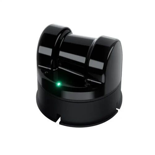
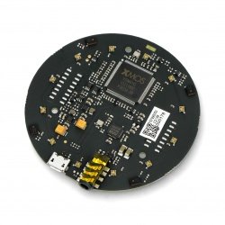
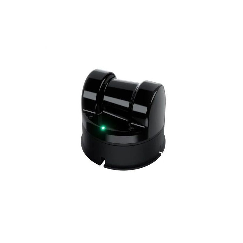
LiDAR 4D Unitree L2 RM - 360° laser sensor for robots and SLAM mapping.
The Unitree L2 RM LiDAR is an advanced 3D laser scanning sensor designed for precise mapping and autonomous robot navigation.
The Unitree L2 RM LiDAR utilizes advanced 4D technology to simultaneously scan the space and acquire information about the surrounding structure in real time. By combining 3D data with an additional layer of grayscale information (1D grayscale), the device offers exceptionally accurate representation of the environment. This type of data is crucial for autonomous robotic systems, which require reliable sources of information for precise positioning, navigation, and obstacle avoidance . The L2 also supports 2D operation, increasing its versatility.
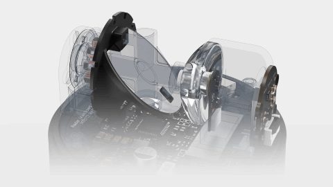
One of the Unitree L2's greatest advantages is its 360° horizontal and 96° vertical field of view , which significantly exceeds most standard sensors . This wide range allows for the complete capture of the robot's surroundings without blind spots, resulting in greater safety and operational efficiency . Thanks to the use of non-contact, brushless rotating mirror technology, scanning is smooth and highly precise , even in dynamic environmental conditions.
The LiDAR L2 provides measurement accuracy of up to 2 cm , a distance resolution of 4.5 mm, and the ability to operate from as close as 0.05 m from a surface. Importantly, the device operates stably in both indoor and outdoor conditions —even in strong sunlight up to 100 Klux. This resistance to light interference makes it ideal for mobile, industrial, and field applications where other sensors often fail.
The manufacturer provides complete, An open-source SLAM solution based solely on LiDAR data and the built-in IMU, eliminating the need for external sensors. Integration with the POINT-LIO algorithm allows you to begin 3D mapping almost immediately after powering on the device . This significantly saves time and resources in R&D, educational, and commercial projects, and is also an ideal solution for autonomous robots that must operate in variable and unfamiliar environments.

It enables robots to accurately recognize their surroundings, identify obstacles and navigate safely in complex scenarios.
| Unitree L2 RM Technical Specifications | |
|---|---|
| Technology | Laser Time of Flight (TOF) |
| Laser wavelength | 905 nm |
| Laser safety class | Class 1 (IEC60825-1:2014) - eye safe |
| Maximum range | 30 m (at 90% reflectivity), 15 m (at 10% reflectivity) |
| Minimum detection distance | 0.05 m |
| Field of View (FOV) | 360° x 90° / 360° x 96° (NEGA mode) |
| Sampling rate | 128000 points/s |
| Effective frequency | 64000 points/s |
| Scanning method | Contactless brushless rotating mirror |
| Data type | 3D position + 1D grayscale (2D mode supported) |
| Horizontal scan rate | 5.55 Hz (adjustable) |
| Vertical scan rate | 216 Hz |
| Communication interface | ENET UDP, TTL UART |
| Transmission speed | 4000000 bps (TTL UART) |
| Measurement accuracy | ≤ 2 cm |
| Angular resolution | 0.64° |
| Distance measurement resolution | 4.5 mm |
| IMU | 3-axis accelerometer + 3-axis gyroscope |
| IMU sampling rate | 1 kHz |
| IMU Reporting Frequency | 500 Hz |
| Perception of orientation | 6 DOF (3 acceleration axes + 3 rotation axes) |
| Angle of spatial perception | 60° |
| LED ring resolution | 60° |
| LED ring refresh rate | 5.55 Hz |
| Resistance to strong light | up to 100 Klux (stable operation in daylight) |
| Operating temperature | from -10°C to 50°C |
| Storage temperature | from -20°C to 60°C |
| Degree of protection | IP54 |
| Power supply | 10 W (typical), up to 13 W in heating mode |
| Supply voltage | 12V DC |
| Work environment | Internal and external |
| Operating modes | 3D / 2D / NEGA Mode (360° x 96°) |
| Software | Support for the POINT-LIO algorithm (open-source SLAM) |
| Thermal safety | Automatic self-heating mode and overheating protection (85°C) |
| Dimensions | 75 x 75 x 65 mm |
| Mass | 230 g |
Useful links |
| Niebezpieczne | Component |
| Package width | 17 cm |
| Package height | 13 cm |
| Package depth | 9 cm |
| Package weight | 0.476 kg |
Be the first to ask a question about this product!
Product Information
The product is a component intended for further assembly/prototyping. It does not constitute a standalone finished product within the meaning of product safety regulations.
Dane GPSR
Country of Origin: Poland
Manufacturer Contact Details: INNPRO Robert Błędowski Sp. z o.o., ul. Rudzka 65c, 44-200 Rybnik
EU Marketer Contact Details: INNPRO Robert Błędowski Sp. z o.o., ul. Rudzka 65c, 44-200 Rybnik